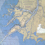
There are many definitions of the Flats. Some say it is only along the South Channel, where the guides and market-hunters first built their shanties in the 1800's; others include the rest of Harsens Island. Is the Canadian side part of the Flats? (More of the delta is in Canada than in the United States.) I'll be generous and say that anything fed by the St. Clair River is the Flats, but to me it brings to mind only the area around the Sni. My Flats.
The US side of the Flats is bounded by the North and South Channels. The river splits at Algonac. MI, with the North Channel snaking west to Anchor Bay and the South Channel running southwest through the Flats to the lake. These two carry most of the water -- a half mile wide and up to 70 feet deep, or more, where the fast current scours the bottom. Part way down the North Channel, the Middle Channel branches off to the southwest.
A little farther down is the Sni. Locally called (and written, even in official documents) the Sni, or Sni Bora, this fourth of the major channels of the Flats cannot be found on any chart. On charts it is always Chenal A Bout Rond (roughly -- The Round-Ended Channel). If you use just the right accent and slur the words just right, it sounds almost like Sni Bora. This causes no end of confusion for visiting boaters (at least for the ones who have charts.)
Each of these channels, and the ones on the Canadian side, feed dozens and hundreds of smaller waterways.These are the Cuts, Channels, Chenals, Highways, Rivers and Creeks that feed the marshes that are the Flats.
Two-thirds of the way down the Sni is the Doty Highway. 50 to 100 feet wide in most places, it snakes its way across a shallow bay and then bears south between a line of cottages and a patch of marsh to Goose Bay. At the end of the string of cottages nearest the Sni, is "the" cottage.